
The North Fork ends in a low point of land facing a fast channel, a leaning iron lighthouse and an island no one visits. Most people pass straight through to the ferry. Stop for an hour first.
On the water: Strong, fast tidal current in Plum Gut off the point; rocky shore, cold water, not a swimming spot.
- Best months May, June, September, October
- Getting there Route 25 east to the end
- Bring Windproof layer, binoculars, camera, ferry booking
Orient Point is the very end of the North Fork, the place where Route 25 stops at the water. It is a low, windy tip of land with a ferry terminal, a small county park, a stony beach and a view east across one of the busiest channels in these waters. Offshore stands Orient Point Light, a short cast-iron tower known as the Coffee Pot. Beyond it lies Plum Island, and beyond that, on a clear day, the line of islands that runs toward Fishers Island and the Connecticut shore.
Most traffic here is heading for the ferry, and many travellers see the point only through a car windscreen. It deserves a short stop of its own, especially in the late afternoon when the light is low over the water.
The end of the road
The last miles of Route 25 run east from Orient village past fields, marsh and the turn for Orient Beach State Park, then end at the ferry terminal. There is no town at the point itself, only the terminal, its parking and the water.
Just before the terminal, a small county park protects part of the point. A path leads through low woods and scrub to a rocky beach facing the channel, and from here you get a clear view of the lighthouse. The beach is made of cobbles and boulders rather than sand, and the footing can be awkward. Check the park's current hours and access rules before you go, as these can change.
Orient Point Light, the Coffee Pot
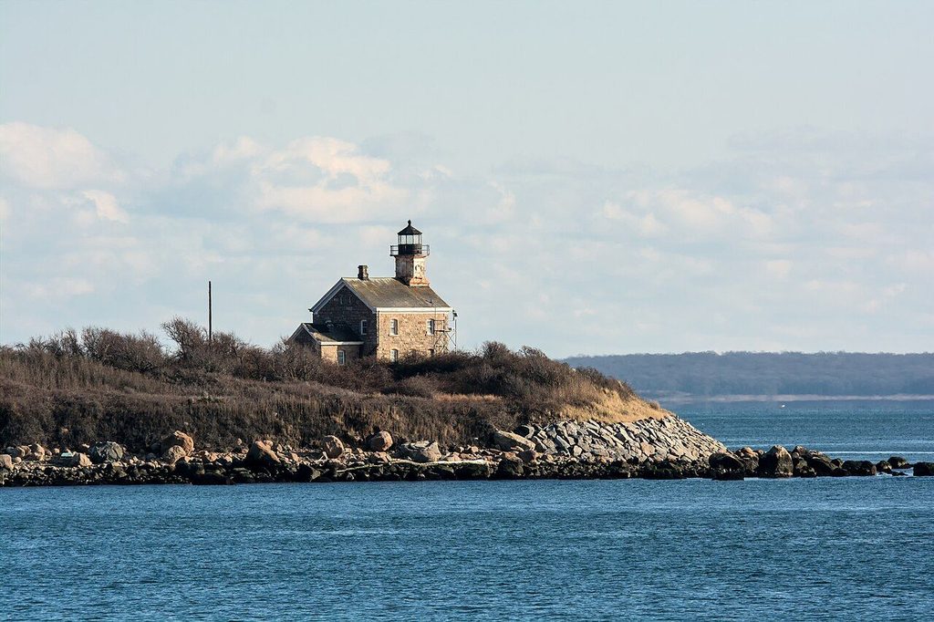
Orient Point Light stands on Oyster Pond Reef, a rocky ledge that runs out from the point into Plum Gut. It was built at the end of the nineteenth century as a cast-iron caisson tower, painted in dark and light bands, and its squat, rounded shape earned it the nickname Coffee Pot. Over the years it has developed a slight but visible lean, which makes it easy to pick out from shore.
The light is still an active aid to navigation and has long been automated. It is not open to visitors and cannot be reached on foot. The best views are from the beach at the county park, with binoculars, or from the deck of the ferry as it passes close by on the way out of the channel. Occasional summer boat trips from the North Fork pass near the light; check what is running before you go.
i
Russ · CC BY 2.0Plum Gut and Plum Island
The channel between Orient Point and Plum Island is Plum Gut, a narrow passage where water moving between Long Island Sound and Gardiners Bay squeezes through with every tide. The current here is strong and fast, and on a windy day with the tide running against the wind the water stands up in steep, choppy waves. Fishing boats gather in the Gut because the moving water brings fish with it, but it is no place for swimming, wading far out or small craft without experience.
Plum Island lies just offshore across the Gut. It holds a federal facility and is not open for casual visits, so treat it as part of the view. Its old stone lighthouse is visible from the ferry, standing on the western end of the island.
From the beach or the ferry deck you can see other islands farther east on a clear day. Watching the water is often the best part of a stop here: the lines of current, the gulls working over feeding fish, the ferries sliding past the lighthouse.
See also: Southold and the Sound-side bluffs
The ferry to New London
A car and passenger ferry runs across Long Island Sound from Orient Point to New London, Connecticut, through the year. The crossing takes roughly an hour and a half on the conventional boats, and a faster passenger-only service has operated in some seasons. Schedules, fares and vehicle reservation rules change with the season and from year to year, so check the current timetable and book ahead for a vehicle, especially on summer weekends and holiday Fridays and Sundays, when the boats fill early.
The crossing itself is worth taking even as a round trip. Leaving Orient Point, the boat passes the Coffee Pot at close range, runs through Plum Gut with Plum Island to the right, and heads out into the Sound. On the Connecticut side you approach New London past its own harbor lights. For many travellers from New England, this ferry is the quiet back door to the North Fork, avoiding the long drive through New York City.
i
uncredited · Public domain
A little history
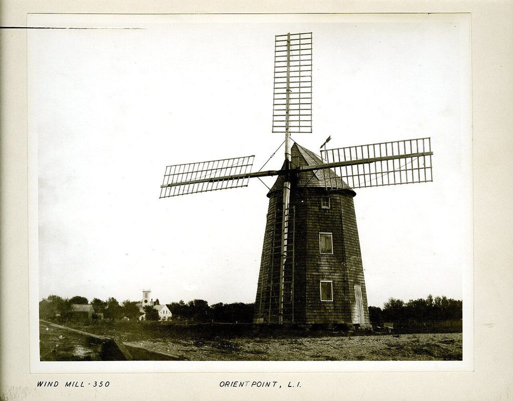
Orient was settled by English colonists in the seventeenth century and for a long time was known as Oysterponds, after the shallow ponds and harbors where shellfish grew in great numbers. The village took the name Orient in the nineteenth century, a nod to its position at the eastern tip of the fork. Windmills once stood across the North Fork to grind grain, and old photographs show them at Orient as well. The village's history is told in more detail in the guide to the fields and old houses along Route 25.
Making the most of a stop
Allow an hour if you are not taking the ferry, or arrive early if you are. Late afternoon and early evening bring the best light on the lighthouse and the water, and on a clear evening the sun sets behind you over the fork while the ferries come and go in the channel.
- Bring a windproof layer: the point is exposed in every season.
- Wear shoes that grip on wet cobbles.
- Binoculars make the lighthouse, the island and the birds far more interesting.
- Check the ferry timetable and any parking rules at the terminal before you go.
On the way back west, the next obvious stop is Greenport, a short drive away, where the harbor and waterfront are covered in the guide to Greenport's harbor and waterfront.