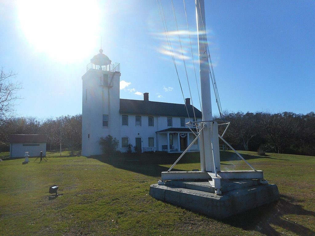
On the north side of the fork, high bluffs drop to stony beaches on Long Island Sound. Southold's lighthouse stands at the top, and the old village lies a short drive inland.
On the water: Rocky Sound beach with cobbles and boulders; small waves, cooler water than the bays, slippery stones at low tide.
- Best months May, June, September, October
- Getting there Route 25 to Southold, then north
- Bring Sturdy shoes, binoculars, warm layer for evening
The North Fork has two shores. The south side faces the shallow, sheltered Peconic bays. The north side faces Long Island Sound, and here the land ends in steep bluffs of sand and clay left by the glaciers, with beaches of cobbles and boulders below. The town of Southold covers most of this stretch, and its old village sits a short distance inland from the Sound, on Route 25.
A day here combines the lighthouse and the beaches on the Sound side with a walk through the village and, if the sky is clear, an evening at the observatory.
Horton Point Lighthouse
Horton Point Lighthouse stands on a high bluff above the Sound, at the end of a quiet residential road north of Southold village. It was built in the mid-nineteenth century, a square tower attached to a two-storey keeper's house, and it sits in a small park of lawns and trees. The light was decommissioned in the twentieth century and later relit, and it again serves as an aid to navigation.
The keeper's house holds a small nautical museum run by a local historical group, open on a limited seasonal schedule, usually on summer weekends. When it is open, you may be able to climb the tower for a view over the Sound. Check the current opening days before you go. The grounds are open more widely, and the lawn on the bluff is a fine spot for a picnic with the water spread out below.
The cobble beaches below the bluffs
From the lighthouse grounds, steps lead down the bluff to the beach. The Sound shore here is nothing like the sandy bay beaches farther east. It is a mix of rounded cobbles, coarse sand and large glacial boulders, some of them the size of cars, dropped when the ice sheet melted back. At low tide, more rock is exposed and the walking gets slippery.
The water of the Sound is cooler than the shallow bays, and the waves are usually small. Swimming is possible on calm days at the town beaches along this shore, but there are no lifeguards on the stretches below the lighthouse. Treat the steps and the bluff with care: the bluffs erode, especially after storms, and you should never climb or dig into them or stand at the very edge.
Beachcombing is the main pleasure. Look for smooth, banded stones, bits of sea glass worn by years in the surf, and the shells of slipper snails and whelks. On a clear day you can see the Connecticut shore across the water. Leave the stones where you find them, and be careful of the tide line, where seaweed covers the rocks and makes them very slick. A walk along the base of the bluff in either direction shows how the shore changes from one cove to the next, from fine gravel to heaped boulders.
See also: Farm stands and fields along Route 25
Southold village
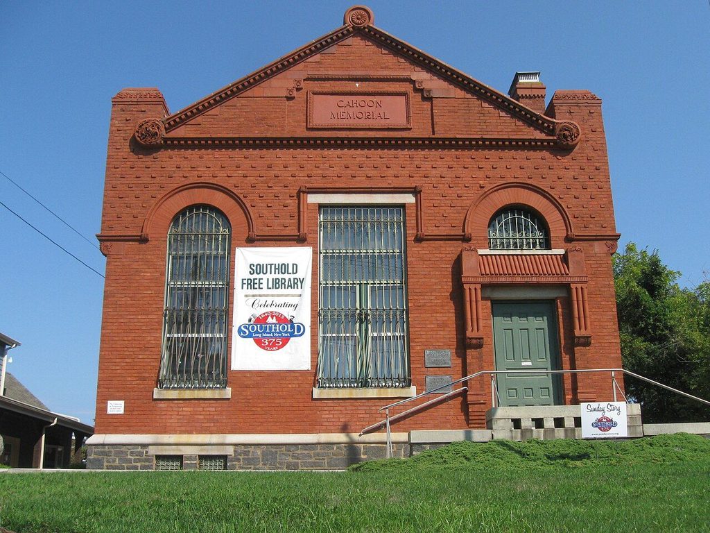
Southold is one of the oldest English settlements in New York, founded in the seventeenth century, and the village along Route 25 keeps a strong sense of its past. Old houses, churches and a historic burying ground line the main road, with the town's historical society maintaining a group of restored buildings nearby. The red brick library on Main Street is a landmark of its own.
i
Kosboot · CC BY-SA 4.0The village centre is small: a stretch of shops and offices around the main crossroads, with the train station a few streets away. Walk it slowly, look at the dates on the houses, and step into the old burying ground if it is open. The quiet side streets lead north toward the Sound and south toward the bay.
Peconic and the roads between
Just west of Southold, the hamlet of Peconic sits where Peconic Lane meets Route 25. The lane runs north across the fork toward the Sound, past fields and older buildings, and it makes a good short cut between the two main roads. Like much of the fork, the land between the hamlets is still largely farmland, with vineyards and fields stretching away from the road. In season, many of the fields sell their produce at the roadside; the guide to farm stands and fields along Route 25 describes what grows when.
Route 48, the northern of the two main roads, runs close to the Sound and has pull-offs and small town beaches with views over the water. It is the faster road, while Route 25 is the slower, older one through the villages.
Stars at the Custer Institute
Southold is home to the Custer Institute, a long-established public observatory run by volunteers. The North Fork has darker skies than most of Long Island, and the observatory holds public viewing sessions on certain evenings, weather permitting, along with talks and other events. A small fee or donation is usually asked. Check the schedule before you go, as sessions depend on the season and are cancelled when it is cloudy.
Dress warmly even in summer: evenings by the Sound can be cool, and you spend much of the time standing still. Allow your eyes time to adjust to the dark, and keep phone screens dimmed.
Planning the day
- Begin at the lighthouse in the morning, when the museum may be open and the bluff is in good light.
- Walk the cobble beach at low or mid tide, in shoes that grip.
- Spend the afternoon in the village and on the back roads.
- Finish at the observatory on a clear night, or drive east to Greenport for the evening.
From Southold, Greenport and its harbor are only a short drive east, covered in the guide to Greenport's harbor and waterfront.